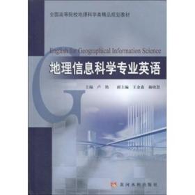
全国高等院校地理科学类精品规划教材:地理信息科学专业英语
¥ 12.97 5.2折 ¥ 25 九品
仅1件
北京东城
认证卖家担保交易快速发货售后保障
作者卢艳 著
出版社黄河水利出版社
出版时间2009-10
版次1
装帧平装
货号A3
上书时间2024-11-19
- 最新上架
商品详情
- 品相描述:九品
图书标准信息
- 作者 卢艳 著
- 出版社 黄河水利出版社
- 出版时间 2009-10
- 版次 1
- ISBN 9787807347378
- 定价 25.00元
- 装帧 平装
- 开本 16开
- 纸张 胶版纸
- 页数 203页
- 字数 99999千字
- 正文语种 简体中文,英语
- 丛书 全国高等院校地理科学类精品规划教材
- 【内容简介】
-
《地理信息科学专业英语》以培养学生地理信息科学专业英语文献阅读和翻译能力为主要目的,以地理信息系统、遥感、全球定位系统和3s集成理论与技术为主要内容,分为4个部分18章内容。第一部分为地理信息系统的基本原理、技术方法及应用,第二部分为遥感基本原理、技术方法及应用,第三部分为全球定位系统的基本原理、技术方法及应用,第四部分为3S集成理论、关键技术及应用。书中每章后均附有专业词汇和难点句子的翻译。
《地理信息科学专业英语》可以作为地理信息系统、遥感和全球定位系统等专业的本科生和研究生的教材,也可供相关专业的技术人员和教师参考使用。 - 【目录】
-
Part1GeographicalInformationSystems
Chapter1OverviewofGeographicalInformationSystems
1.1IntroductiontoGeographicalInformationSystems
1.2BriefHistoryofGeographicalInformationSystems
NotesandPhrases
Translations
Chapter2PrinciplesofGeographicalInformationSystems
2.1RepresentingofGeographicalFeaturesintheRealWorld
2.2SpatialDataModels
2.3RasterandVectorStorage
2.4OrganizingAttributeData
NotesandPhrases
Translations
Chapter3Geo-referencing
3.1Geodesy
3.2MapProjection
3.3CoordinateSystems
NotesandPhrases
Translations
Chapter4GeospatialData
4.1DataCollection
4.2Uncertainty
4.3GeospatialDatabaseStructure
NotesandPhrases
Translations
Chapter5SpatialAnalysis
5.1DatabaseQuery
5.2Reclassification
5.3OverlayAnalysis
5.4ConnectivityAnalysis
5.5ShapeAnalysisandMeasurement
5.6SpatialInterpolation
5.7Geo-visualization
NotesandPhrases
Translations
Chapter6ApplicationsofGIS
6.1AnOverviewofEnvironmentalManagementandConservation
6.2GISandPublicHealth
NotesandPhrases
Translations
Part2RemoteSensing
Chapter7FundamentalsofRemoteSensing
7.1IntroductiontoRemoteSensing
7.2PhysicalBasisofRemoteSensing
NotesandPhrases
Translations
Chapter8RemoteSensingImagingPrinciples
8.1RemoteSensingPlatform
8.2MicrowaveSensors
NotesandPhrases
Translations
Chapter9RemoteSensingDigitalImagesProcessing
9.1IntroductionofRemoteSensingDigitalImages
9.2ImageProcessing
NotesandPhrases
Translations
Chapter10RemoteSensingImageInterpretation
10.1ElementsofImageInterpretation
10.2DigitalImageInterpretation
NotesandPhrases
Translations
Chapter11RemoteSensingApplications
11.1VegetationRemoteSensing
11.2GeologicalRemoteSensing
11.3WaterRemoteSensing
11.4LandCover/UseRemoteSensing
11.5SnowandCloudsremoteSensing
NotesandPhrases
Translations
Part3GlobalPositioningSystem
Chapter12IntroductiontoGlobalPositioningSystem
12.1OverviewofGPSHistory
12.2GPSSegments
12.3TheBasicPrincipleofGPS
12.4OtherSatelliteNavigationandPositioningSystems
NotesandPhrases
Translations
Chapter13Datums,CoordinateSystemsandTimeSystems
13.1TheDatumsandCoordinateSystemsofGPS
13.2TheTimeSystemsofGPS
NotesandPhrases
Translations
Chapter14GPSSignalStructureandBasicMeasuringWays
14.1TheGPSSignalStructure
14.2TheBasicMeasuringwaysofGPS
NotesandPhrases
Translations
Chapter15GPSErrorsandBiases
15.1GPSEphemerisErrors
15.2SelectiveAvailability
15.3SatelliteandReceiverClockErrors
15.4MultipathError
15.5Antenna-pase-centerVariation
15.6ReceiverMeasurementNoise
15.7IonosphericDelay
15.8TroposphericDelay
15.9SatelliteGeometryMeasures
15.10GPSMissionPlanning
15.11UserEquivalentRangeError
NotesandPhrases
Translations
Chapter16GPSPositioningModes
16.1GPSPointPositioning
16.2GPSRelativePositioning
16.3StaticGPSSurveying
16.4Fast(Rapid)StaticSurveying
16.5Stop-and-goGPSSurveying
16.6RTKGPSSurveying
16.7Real-timeDifferentialGPS
16.8Real-TimeProcessingVersusPostprocessing
16.9Communication(Radio)Link
NotesandPhrases
Translations
Chapter17GPSApplications
17.1UsesofGPSTechnology
17.2GPSApplications
NotesandPhrases
Translations
Part43SIntegration
Chapter18TheBasicPrinciplesof3SIntegration
18.1DefinitionoftheIntegrationofGPS,RS&GIS
18.2TheBasicPhilosophyof3STechnologyIntegration
18.3TheIntegrationModesof3STechnology
18.4OverallIntegrationof3S
18.53SIntegrationandGeo-spatialInformationScience
NotesandPhrases
Translations
References
点击展开
点击收起
相关推荐
— 没有更多了 —














以下为对购买帮助不大的评价