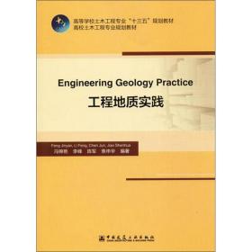
工程地质实践
¥ 20 5.6折 ¥ 36 九五品
仅1件
河北廊坊
认证卖家担保交易快速发货售后保障
作者冯锦艳、李峰、陈军、焦申华 著
出版社中国建筑工业出版社
出版时间2019-12
版次1
印数1千册
装帧平装
上书时间2024-05-28
- 最新上架
商品详情
- 品相描述:九五品
图书标准信息
- 作者 冯锦艳、李峰、陈军、焦申华 著
- 出版社 中国建筑工业出版社
- 出版时间 2019-12
- 版次 1
- ISBN 9787112244447
- 定价 36.00元
- 装帧 平装
- 开本 16开
- 纸张 胶版纸
- 页数 124页
- 【内容简介】
- 《工程地质实践》为“工程地质学”配套的实习教材,阐述工程地质学实习的基础内容和基本方法。全书共8章,主要包括造岩矿物与三大类岩石的鉴定、地质罗盘仪的使用、地质构造的野外观察与分析、地质图的使用与阅读、中外关于工程地质的主要差异比较、世界有名地质奇迹赏析以及典型路线的地质实习等。《工程地质实践》可作为高等学校土木工程、机场工程、水利工程、交通运输工程及相关专业的本科生和研究生的教学用书或教学参考书,也可作为留学生,尤其是“一带一路”沿线国家留学生的教学用书。《工程地质实践》也可供参加中国土木工程、岩土工程以及环境评价工程等资格考试的人员参考。
- 【目录】
-
Chapter 1 Identification of common rock-forming minerals
1.1 Purposes and requirements
1.2 Common tools
1.3 Identification methods of rock-forming minerals
1.4 Practice contents
1.4.1 Morphological observation of mineral monomers
1.4.2 Morphological observation of mineral aggregations
1.4.3 Color observation of minerals
1.4.4 Streak observation of minerals
1.4.5 Gloss observation of minerals
1.4.6 Transparency observation of minerals
1.4.7 Cleavage and fracture observation of minerals
1.4.8 Hardness observation of minerals
1.4.9 Specific gravity observation of minerals
1.4.10 Magnetism observation of minerals
1.4.11 Luminescent observations of minerals
1.4.12 Sensory characteristic observation of minerals
1.4.13 Other characteristics observation of minerals
1.5 Internship report
1.6 Thinking questions
Chapter 2 Rock identification
2.1 Purposes and requirements
2.2 Common tools
2.3 Identification method
2.3.1 Texture differences of three kinds of rocks
2.3.2 Structure differences of three kinds of rocks
2.4 Identification of igneous rocks
2.4.1 Classification of igneous rocks
2.4.2 Color of igneous rock
2.4.3 Mineral composition of igneous rock
2.4.4 Texture and structure of igneous rock
2.4.5 To name igneous rock
2.4.6 The characteristics of common igneous rock
2.4.7 Identification method of igneous rocks by naked eyes
2.4.8 An identification example of igneous rock
2.5 Identification of sedimentary rock
2.5.1 Color of sedimentary rock
2.5.2 Material composition of sedimentary rock
2.5.3 Texture of sedimentary rock
2.5.4 Structure of sedimentary rock
2.5.5 To name the sedimentary rock
2.5.6 Characteristics of common sedimentary rock
2.5.7 Identification method of sedimentary rocks by naked eyes ~
2.6 Identification of metamorphic rock
2.6.1 Classification of metamorphism
2.6.2 Mineral composition of metamorphic rock
2.6.3 Texture of metamorphic rock
2.6.4 Structure of metamorphic rock
2.6.5 To name the metamorphic rock
2.6.6 Classification of metamorphic rocks
2.6.7 Characteristics of common metamorphic rocks
2.6.8 Identification method of metamorphic rocks
2.7 The basic identification method of three kinds of rocks in the field
2.8 Internship report
2.9 Thinking questions
Chapter 3 Use of geological compass instrument
3.1 Structure of geological compass instrument
3.1.1 Compass
3.1.2 Tilt meter
3.2 Use method of geological compass instrument
3.2.1 Declination correction
3.2.2 Azimuth measurement steps
3.2.3 Compass use precautions
3.3 Strata attitude measurement
3.3.1 Determination of the strike direction of strata
3.3.2 Determination of the dip direction of strata
3.3.3 Determination of dip angle of strata
3.3.4 Attitude measurement at steep slope
3.3.5 Attitude representation method
3.4 Internship report
3.5 Thinking questions
Chapter 4 Field observation and analysis of geological structure
4.1 Field observation of uniclinal structure
4.2 Field observation of fold structure
4.3 Field observation of fault
4.3.1 Field identification of fault
4.3.2 Field characteristics of fault
4.3.3 Motions direction determination of the two walls of fault
4.3.4 Scale observation of faults
4.4 Field survey and statistics of joints
4.4.1 Strike direction rosette of Joint
4.4.2 Dip direction rosset of joint
4.5 Practice content
Chapter 5 Topographic map and geological map
5.1 Topographic map
5.1.1 Scale of topographic map
5.1.2 Contour lines
5.1.3 Features of all kind of terrain
5.1.4 Ground features symbols
5.1.5 How to read the topographic map
5.2 Application of topographic map
点击展开
点击收起
相关推荐
— 没有更多了 —


以下为对购买帮助不大的评价