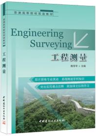
工程测量(高等院校十三五规划教材)(英文版)
¥ 44.88 5.3折 ¥ 85 全新
库存2件
作者邹维宝 编
出版社西北工业大学出版社
出版时间2021-11
版次1
装帧平装
货号zz
上书时间2024-11-29
- 在售商品 暂无
- 平均发货时间 15小时
- 好评率 暂无
- 最新上架
商品详情
- 品相描述:全新
图书标准信息
- 作者 邹维宝 编
- 出版社 西北工业大学出版社
- 出版时间 2021-11
- 版次 1
- ISBN 9787561280409
- 定价 85.00元
- 装帧 平装
- 开本 16开
- 页数 335页
- 字数 567千字
- 【内容简介】
-
本书适用于国家高等院校土木工程专业。本书总共有11章。第l章到第5章系统地介绍测量的基本知识、测量仪器、测量原理和测量校正方法。第6章是控制测量,包括导线测量和三角测量。第7章介绍现代测量的高新技术,如各国开发的几种卫星定位系统。第8章和第9章是关于曲线和土方工程的。第10章介绍一些常用的放样方法。最后一章介绍地下测量的基本知识。
本书主要用作高等院校土木工程技术及相关专业的工程测量教材,也可供技术人员参考。 - 【作者简介】
-
邹维宝,2004年获理工大学摄影测量与遥感专业博士。副教授,导师长期从事遥感图像处理及模式识别方面的研究,评审专家、他还是多个国际英文ci期刊评审专家。 - 【目录】
-
Chapter 1 Basis of surveying
1.1 Definition
1.2 Divisions of surveying
1.3 Classification of surveying
1.4 Principles
1.5 Procedures
1.6 Systems of references
1.7 Coordinate systems
1.8 Height
Chapter 2 Error and uncertainty
2.1 Accuracy and precision
2.2 Units of measurement
2.3 Significant figures
2.4 Rounding numbers
2.5 Errors in measurement
2.6 Indices of precision
Chapter 3 Levelling
3.1 Introduction
3.2 Definitions
3.3 First-, second-, and third-order surveys
3.4 Curvature and refraction
3.5 Equipment
3.6 Principle of levelling
3.7 Sources of error
3.8 Closure tolerances
3.9 Error distribution
3.10 Levelling applications
3.11 Reciprocal levelling
3.12 Precise levelling
3.13 Digital levelling
3.14 Trigonometrical levelling
Chapter 4 Distance measurement
4.1 Tapes
4.2 Field work
4.3 Distance adjustment
4.4 Errors in taping
4.5 Accuracies
4.6 Electromagnetic distance measurement (EDM)
4.7 Measuring principles
4.8 Geometrical reductions
Chapter 5 Angle measurement
5.1 The theodolite
5.2 Instrumental errors
5.3 Instrument adjustment
5.4 Field procedure
5.5 Measuring angles
5.6 Sources of error
Chapter 6 Conventional control surveys
6.1 Plane rectangular coordinates
6.2 Traversing
6.3 Triangulation
6.4 Networks
Chapter 7 Satellite positioning
7.1 Introduction
7.2 GPS segments
7.3 GPS receivers
7.4 Basic principle of position fixing
7.5 GPS observing methods
7.6 Error sources
7.7 GPS survey planning
7.8 GLONASS
7.9 European geostationary navigation overlay service (EGNOS)
7.10 Galileo
7.11 Compass (BeiDou)
7.12 The future for surveyors and engineers
7.13 Applications
Chapter 8 Curves
8.1 Circular curves
8.2 Setting out curves
8.3 Compound and reverse curves
8.4 Short and/or small-radius curves
8.5 Transition curves
8.6 Setting-out data
8.7 Vertical curves
Chapter 9 Earthworks
9.1 Areas
9.2 Partition of land
9.3 Cross-sections
9.4 Dip and strike
9.5 Volumes
Chapter 10 Setting out (dimensional control)
10.1 Responsibility on site
10.2 Responsibility of the setting-out engineer
10.3 Protection and referencing
10.4 Basic setting-out procedures using coordinates
10.5 Use of grids
10.6 Setting out buildings
10.7 Controlling verticality
10.8 Controlling grading excavation
10.9 Rotating lasers
10.10 Laser hazards
10.11 Route location
Chapter 11 Underground surveying
11.1 Optical methods
11.2 Mechanical methods
11.3 Gyro-theodolite
11.4 Line and level
References
相关推荐
-

工程测量(高等院校十三五规划教材)(英文版)
全新无锡
¥ 63.75
-

工程测量(高等院校十三五规划教材)(英文版)
全新长沙
¥ 39.11
-

工程测量(高等院校十三五规划教材)(英文版)
全新无锡
¥ 52.91
-

工程测量(高等院校十三五规划教材)(英文版)
九品保定
¥ 20.00
-

工程测量(高等院校十三五规划教材)(英文版)
全新九江
¥ 46.58
-

普通高等院校双语教材:工程测量
全新保定
¥ 13.10
-

普通高等院校双语教材:工程测量
全新泰安
¥ 34.12
-

普通高等院校双语教材:工程测量
八五品济南
¥ 5.00
-

普通高等院校双语教材:工程测量
全新泰安
¥ 32.12
-

普通高等院校双语教材:工程测量
八五品镇江
¥ 1.90
— 没有更多了 —


以下为对购买帮助不大的评价