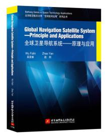
Globa lNavigation Satellite System—Principle and
¥ 24.55 2.5折 ¥ 99 九品
仅1件
作者Wu、Falin吴发林、ZhaoYan赵剡 著
出版社北京航空航天大学出版社
出版时间2017-07
版次1
装帧平装
货号A19
上书时间2024-11-01
- 在售商品 暂无
- 平均发货时间 15小时
- 好评率 暂无
- 最新上架
商品详情
- 品相描述:九品
图书标准信息
- 作者 Wu、Falin吴发林、ZhaoYan赵剡 著
- 出版社 北京航空航天大学出版社
- 出版时间 2017-07
- 版次 1
- ISBN 9787512423473
- 定价 99.00元
- 装帧 平装
- 开本 16开
- 纸张 胶版纸
- 【内容简介】
-
GlobalNavigationSatelliteSystem—PrincipleandApplications全球卫星导航系统—原理与应用
ThisbookprovidesanoverviewoftheprinciplesofoperationofGlobalNavigationSateliteSysiems(GNSS,i.e.,GPS,GLONASS,BeiDouandGalileo)withprimaryemphasisontheGPS.Itcoversthefundamentalsofbothhardwareandalgorithms/softwareaspectsofGNSS.ThisbookisintendedtoserveasatextbookforbothundergraduatesandpostgraduatesinterestedinpursuingstudyinGNSS.Itisalsointendedasasourceofinformationforengineers,geodesists,surveyors,navigators,teachers,etc.,whohaveaninterestinradionavigationprinciplesandsystems.
- 【目录】
-
Chapter 1 Introduction
1.1 Overview
1.2 U.S. Global Positioning System
1.2.1 GPS Services
1.2.2 GPS Modernization Program
1.3 Russian GLONASS System
1.4 Chinese BeiDou Satellite Navigation System
1.4.1 BeiDou Program History
1.4.2 BeiDou Services
1.5 European Galileo Satellite System
1.6 Augmentations
1.7 Organization of the Book
Review Questions
Chapter 2 Fundamentals of Satellite Navigation
2.1 Methods of Radionavigation
2.1.1 Trilateration
2.1.2 Hyperbolic Positioning
2.1.3 Doppler Positioning
2.2 Concept of Ranging Using TOA Measurements
2.2.1 Two-Dimensional Position Determination
2.2.2 Principle of Position Determination via Satellite-Generated Ranging Signals
2.3 Reference Coordinate Systems
2.3.1 Earth-Centered Inertial Coordinate System
2.3.2 Earth-Centered Earth-Fixed Coordinate System
2.3.3 World Geodetic System
2.3.4 Height Coordinates and the Geoid
2.3.5 GLONASS Coordinate Reference System
2.3.6 BeiDou Geodetic Reference System
2.3.7 Galileo Coordinate Reference System
2.4 Time References and GNSS Time
2.4.1 Time Scales. Astronomical and Atomic
2.4.2 GNSS System Time
2.5 Fundamentals of Satellite Orbits
2.6 Position, Velocity and Time Estimation
2.6.1 Determining Satellite-to-User Range
2.6.2 Calculation of User Position
2.6.3 User Velocity Estimation
2.6.4 Time Estimation
Review Questions
Chapter 3 Functional Segments of GNSS
3.1 Overview of the GNSS System
3.1.1 Space Segment Overview
3.1.2 Control Segment Overview
3.1.3 User Segment Overview
3.2 Space Segment
3.2.1 GPS Space Segment
3.2.2 GLONASS Space Segment
3.2.3 BeiDou Space Segment
3.2.4 Galileo Space Segment
3.3 Control Segment
3.3.1 GPS Control Segment
3.3.2 GLONASS Control Segment
3.3.3 BeiDou Control Segment
3.3.4 Galileo Control Segment
3.4 User Segment
Review Questions
Chapter 4 Stand-Alone GNSS Performance
4.1 Introduction
4.2 GNSS Error Sources
4.2.1 Satellite Clock Error
4.2.2 Ephemeris Error
4.2.3 Relativistic Effects
4.2.4 Atmospheric Effects
4.2.5 Receiver Noise and Resolution
4.2.6 Multipath and Shadowing Effects
4.2.7 Hardware Bias Errors
4.2.8 Pseudorange Error Budgets
4.3 Accuracy
4.3.1 Satellite Geometry and Dilution of Precision in GPS
4.3.2 Accuracy Metrics
4.3.3 Weighted Least Squares (WLS)
4.3.4 Additional State Variables
4.3.5 Kalman Filtering
4.4 Availability
4.5 Integrity
4.5.1 Discussion of Criticality
4.5.2 Sources of Integrity Anomalies
4.5.3 Integrity Enhancement Techniques
4.6 Continuity
Review Questions
Chapter 5 GNSS Signals
5.1 Introduction
5.2 Modulations for Satellite Navigation
5.2.1 Modulation Types
5.2.2 Multiplexing Techniques
5.2.3 Signal Models and Characteristics
5.3 GPS Signals
5.3.1 Legacy GPS Signals
5.3.2 Modernized GPS Signals
5.3.3 GPS Signal Summary
5.4 GLONASS Signals
5.4.1 GLONASS Frequencies
5.4.2 Modulation
5.4.3 Code Properties
5.5 BeiDou Signals
5.5.1 BeiDou Frequencies
5.5.2 Open Service Signals
5.5.3 Ranging Code
5.6 Galileo Signals
5.6.1 Frequencies and Signals
5.6.2 Modulation Schemes
5.6.3 SAR Signal Plan
5.7 Navigation Message Format
5.7.1 GPS Navigation Message
5.7.2 GLONASS Navigation Message
5.7.3 BeiDou Navigation Message
5.7.4 Galileo Navigation Message
Review Questions
Chapter 6 GNSS Receivers
6.1 Introduction
6.2 GPS Receiver Architecture
6.2.1 Radio Frequency (RF) Front End
6.2.2 Frequency Down-Conversion and IF Amplification
6.2.3 Analog-to-Digital Conversion and Automatic Gain Control
6.2.4 Baseband Signal Processing
6.3 GPS Signal Acquisition
6.3.1 Tong Search Detector
6.3.2 M of N Search Detector
6.3.3 Direct Acquisition of GPS Military Signals
6.4 GPS Signal Tracking
6.4.1 Predetection Integration
6.4.2 Baseband Signal Processing
6.4.3 Digital Frequency Synthesis
6.4.4 Carrier Aiding of Code Loop
6.4.5 External Aiding
6.5 Carrier Tracking Loops
6.5.1 Phase Lock Loops
6.5.2 Costas Loops
6.5.3 Frequency Lock Loops
6.6 Code Tracking Loops
6.7 Formation of Pseudorange, Delta Pseudorange, and Integrated Doppler
6.7.1 Pseudorange
6.7.2 Delta Pseudorange
6.7.3 Integrated Doppler
6.8 Data Demodulation
Review Questions
Chapter 7 Differential GNSS
7.1 Introduction
7.2 Spatial and Time Correlation Characteristics of GPS Errors
7.2.1 Satellite Clock Errors
7.2.2 Ephemeris Errors
7.2.3 Ionospheric Errors
7.2.4 Tropospheric Errors
7.2.5 Receiver Noise and Multipath
7.3 Code-Based Techniques
7.3.1 Local-Area DGNSS
7.3.2 Regional-Area DGNSS
7.3.3 Wide-Area DGNSS
7.4 Carrier-Based Techniques
7.4.1 Precise Baseline Determination in Real Time
7.4.2 Static Application
7.4.3 Airborne Application
7.4.4 Attitude Determination
7.5 RTCM Messages
Review Questions
Chapter 8 GNSS Applications
8.1 Introduction
8.2 Marine and Land Applications of GNSS
8.2.1 Marine Navigation
8.2.2 Land Navigation
8.3 Aviation Applications
8.3.1 Classes of Aviation Augmentation Systems
8.3.2 Benefits of GPS and Augmentations to Aviation Users
8.3.3 Future of GNSS Navigation in Aviation
8.3.4 Functionality of Aviation Augmentation Systems
8.4 Space Applications
8.4.1 Operational Considerations
8.4.2 Applications
8.5 GNSS in Surveying, Mapping, and Geographical Information Systems
8.5.1 Surveying
8.5.2 Mapping
8.5.3 Geographical Information System
8.6 GNSS Time Transfer
8.7 Government and Military Applications
8.7.1 Military User Equipments
8.7.2 Autonomous Receivers--Smart Weapons
8.7.3 Other Government Applications
Review Questions
References
内容摘要
。。。
精彩内容
GlobalNavigationSatelliteSystem—PrincipleandApplications卫星导航系统—原理与应用
ThisbookprovidesanoverviewoftheprinciplesofoperationofGlobalNavigationSateliteSysiems(GNSS,i.e.,GPS,GLONASS,BeiDouandGalileo)withprimaryemphasisontheGPS.Itcoversthefundamentalsofbothhardwareandalgorithms/softwareaspectsofGNSS.ThisbookisintendedtoserveasatextbookforbothundergraduatesandpostgraduatesinterestedinpursuingstudyinGNSS
— 没有更多了 —


以下为对购买帮助不大的评价